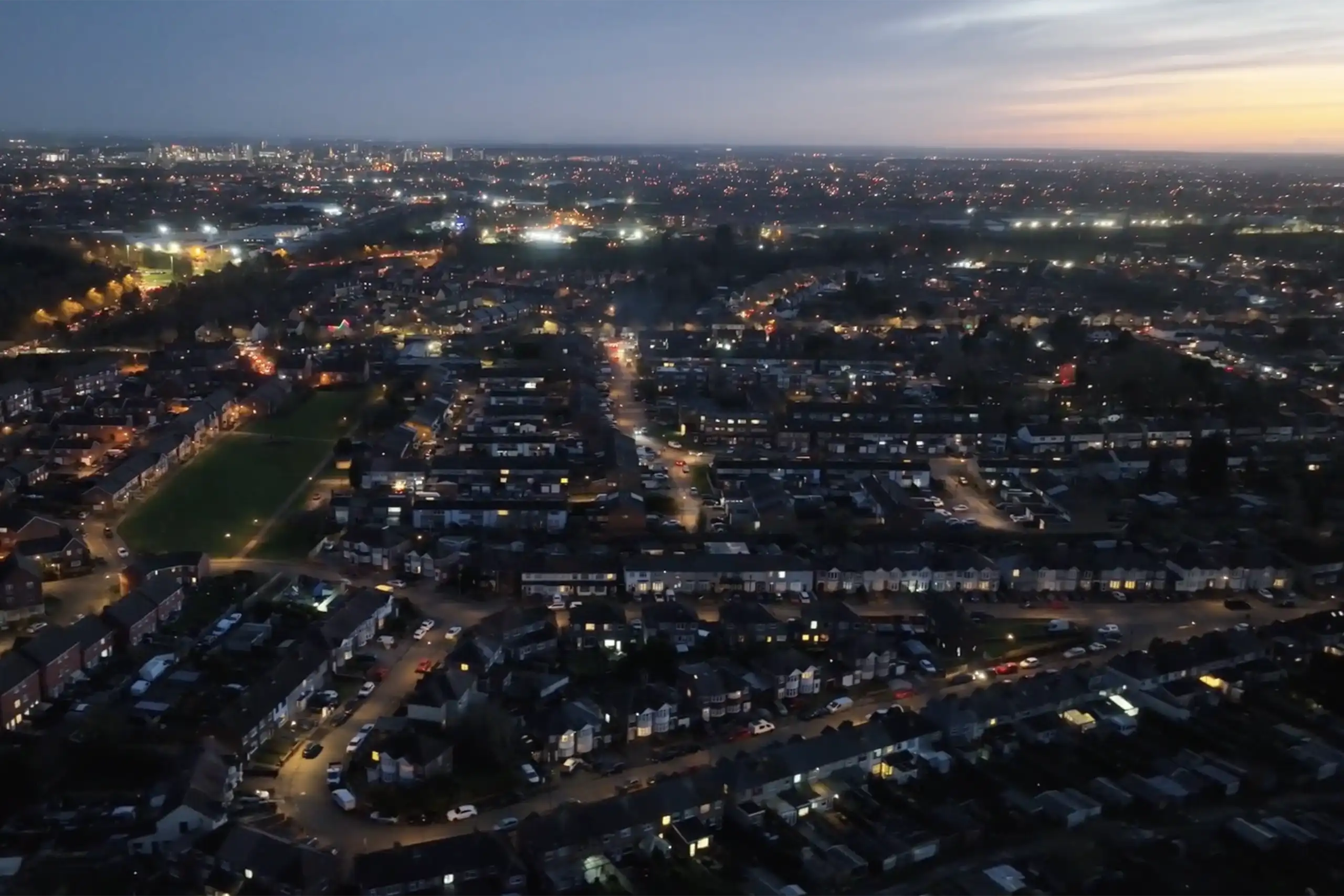
At Skyfarer, we are committed to making drone technology accessible, safe, and effective for real-world applications. Our work with Coventry City Council demonstrates how drones can provide practical efficiencies in urban management, supporting smarter decision-making for public services.
Optimising Traffic Management with Live Insights
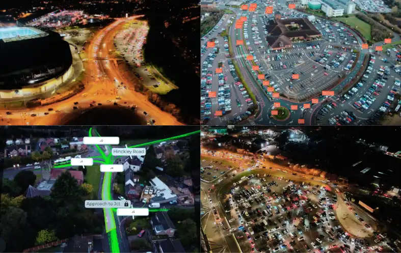
One of the key areas where drones have provided value is traffic flow monitoring. During Coventry City Football Club matches at CBS Arena, our services provided a real-time traffic picture to the city’s management team, helping them respond quickly to congestion and improve traffic coordination with flexibility. Integrated into their control room, the service focussed on specific junction hotspots and crowd movements during road closures, helping improve the flow of vehicles and pedestrians, ensuring a smoother experience for attendees, fans and surrounding road users. While capturing blind spots not covered by fixed traffic cameras, this service also enhanced the live situational awareness and true impacts of decisions enabling on the run optimization.
Through a more proactive approach, our services have also supported the council in understanding vehicle movement patterns at high-traffic locations. Required in areas where multiple junctions impact each other, the ability to present the Council’s team with processed data and report (through AI traffic analysis) ensured quick but informed decision making was present prior to planning.
Infrastructure and Asset Monitoring for Better Urban Planning
Drones play a valuable role in urban planning and infrastructure management, offering high-quality visual data that allows city officials to make informed decisions.
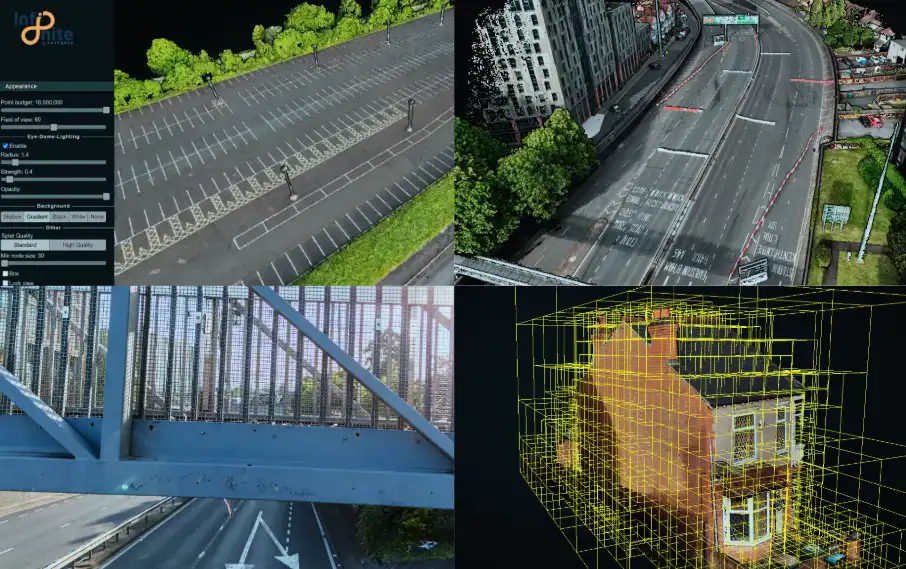
At a glance, our services provided surveys of Coventry’s ring road and footbridges during Motofest closures produced high-resolution orthomosaic maps and 3D models, supporting infrastructure monitoring and maintenance efforts.
Additionally, at CBS Arena’s Car Park C, our modelling provided detailed visual assessments of parking structures, helping to identify potential development needs efficiently.
In relevant residential areas, drones were used to generate 3D models of buildings, supporting assessments for insulation improvements and housing upgrades.
Site Activity and Safety Assessments
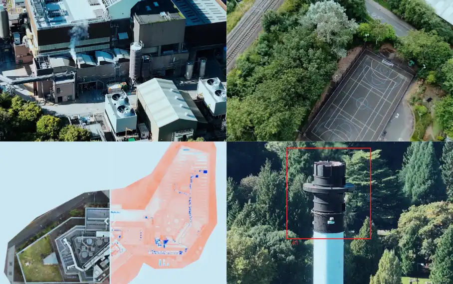
As part of broader site studies, Infinite Services has been used to assess operational activity at key council locations, such as Whitley Depot and recycling centres. By providing situational awareness and capturing accurate site data, this technology helps improve operational efficiency and resource allocation.
At selected schools, we conducted example assessments of the site perimeter during the holiday periods to review boundary and general conditions. While this was a limited-use case, it demonstrated how drones can assist in live situational assessments for property or asset management.
Looking Ahead: Smart City Applications
Skyfarer continues to explore how these services can be integrated into future urban initiatives, including:
• Advanced modelling for infrastructure projects
• Flood risk assessments and environmental monitoring
• Supporting autonomous vehicle trials through high – accuracy mapping
Our focus remains on responsible drone integration – ensuring that aerial technology supports efficiency, sustainability, and public benefit without encroaching on privacy concerns.
To learn more about how Skyfarer can elevate your operations, visit Infinite by Skyfarer.


